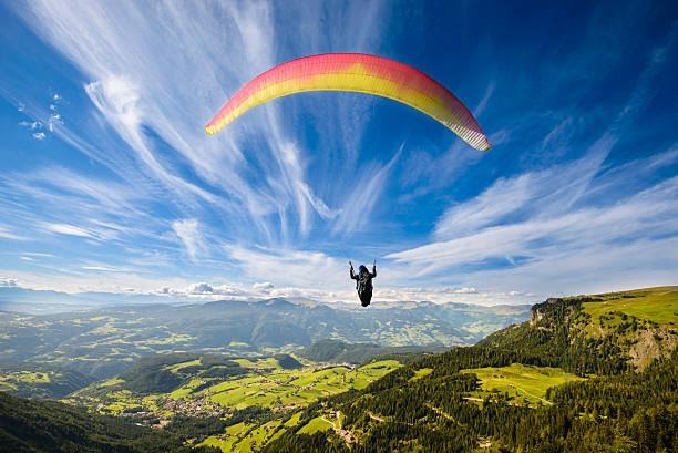
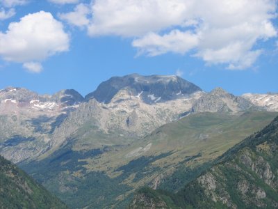
Pico Perdiguero
Preparing our mountain trips for the coming summer, we have agreed to go to the summit of Perdiguero in the Pyrenees in mid-July. From the mountaineering club tiendaescalada.net we carefully plan to climb this peak, documenting as we always do and making a plan.
The summit of Perdigero is a mountain in the Pyrenees, located between Aragon and the Upper Garonne on the border between Spain and France.
There are three main climbing routes: the one that begins in the Barranco de Literola Gorge, the one that starts in the Estos Valley, and the climbs in the Remunier Valley.
Its summit offers a broad view of Huesca and the French Pyrenees. Also from the Maladeta and Posiet massifs.
Its summit was first reached in 1817 by Frederic Parrot and Pedro Barrau; it is at the top of the axial Pyrenees chain. The passes that cross the massif are at about or above three thousand meters.
TECHNICAL DATA
Location: Central Pyrenees.
Height above sea level: 3,222 m.
Height difference: 550 +1,350 = 1,900 meters.
Schedule: 2.30 + 5 = 7.30 hours.
Access: Benasque. Starting point: Estos valley (1 350).
The refuge: Estos (1.890) EA.M.
Season: July-September.
Mapping: the Alps, Posiet-Perdigero.
Terrain: wooded, rocky and stony.
Level of difficulty: medium.
Effort: high.
Risk: medium.
Equipment: high mountains.
How to get there Near Castejón de Sos, change from the N-260 to the A-139, and after 15 km you will reach Benasque. Continuing on the road, which always follows the course of the Esera, after turning right at Cerler, shortly after crossing the bridge of Cuera, on the left, you will find the access road to the valley of Estos.
First, we go around the campsite, then reach the pier, where there are several shelters and where we usually park (1,350) (5 km. from Benasque). Access to the refuge By following the trail along the river bed, passing a bridge, we come out to the open shelter of Santa Ana (1,540). Then there is a bypass road to Cabaña de la Coma, where we have to go down to cross the river. On the left is the Batisielles trail. Finally, the trail disappears into the plain, where we find Cabaña del Turmo (1,730). After crossing the river again, an excellent trail climbs across the riverbed to the Estos Hut (1,890).
The route begins by climbing up the Barranco de Guias gorge to the point where the paths of the Clarabide passes diverge, and we turn right and cross the foothills of the Dera Bacu Rope to reach the Collada de Molseret (2,520). We then cross the rocky Molseret valley on a gentle ascent, advancing under a wall of mountain peaks to get the Collada de Gargallos (2,670). A new uphill flank leads us to the Obago Collado (2,750), which overlooks the Literola Valley. Now we have to climb a broad ridge that leads to Hito Oriental (3,170) and the main summit of Perdiguero (3,222).
If you do not want to return to the refuge, the fastest way back from Collado Obago is through the valley of Perdiguero, and you can join the climbing route to Cabaña del Turmo or through Cabaña de la Coma. It is this open refuge that allows the most direct ascent to Perdiguero.